Route Details
- Length: 1,5 kilometres
- Ascent: 87 metres
- Time: 45 mins
- Grade: Low
- Equipment: Sturdy footwear, water, camera, lunch, swimwear.
Description
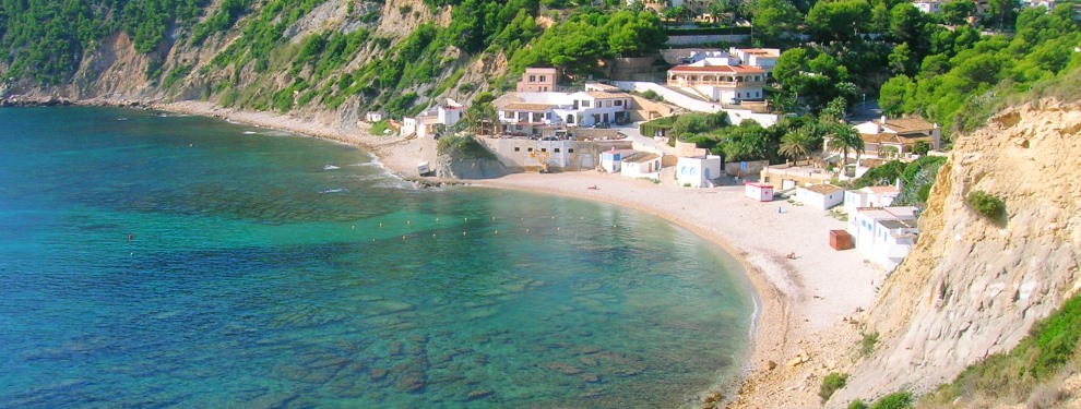
Cala Barraca is a rocky cove situated in the southern half of the bay of Portitxol, guarded on its extremes by the protective booms of Cap Prim and Cap Negre as well as the hulk of the island of Portitxol. The cove takes its name from the small fishing huts (“barracas”) that were built here some years ago, some of which still remain. The bay of Portitxol (“small port”) has been used as an anchorage and landing point for more than two thousand years and archeaological discoveries suggest habitation stretching back to the 7th century BCE.

The Route
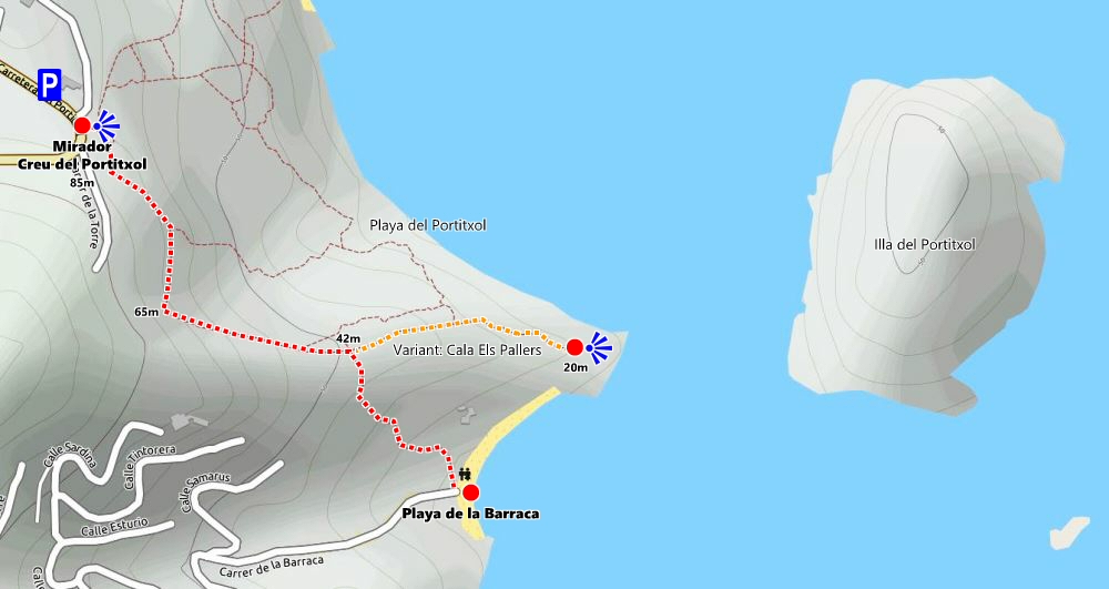
The start is at the Mirador Creu Portitxol, the picturesque viewpoint marked by a small tosca stone cross that overlooks the coast to the east with the island of Portitxol and the Cap Prim headland.
NOTE: There is limited parking on the main road and in Carrer L’Illa and it can be extremely busy during the popular summer months. Unfortunately there are no alternatives other than parking further down the hill in Cala Blanca and walking up to the viewpoint. Drivers should be aware of not blocking gates and driveway for they may return to find their vehicle removed on request of the property owner.
Our destination of Cala Barraca is hidden from view to the right. The route descends along a well-eroded path past a wooden information board which outlines the natural history of the area as well as marking the two walking routes from this location. After a few metres, the path divides with a wooden signpost indicating the two possible destinations: to the left is the short walk to Cap Prim whilst our route heads right into the trees. (At the time of writing, the signpost was incorrectly marked as SL-CV 98; ignore.)
The first few metres of the path are narrow and unfortunately dotted with rubbish left by man. I’d like to think that this detritus hasn’t been left by walkers and those who enjoy the superb natural environment but by visitors to the viewpoint with a less than respectful regard for their surroundings. I acknowledge the problem of being “caught short” in the open but – please – take the paper away with you!
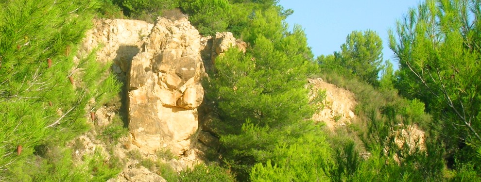
The path then widens and drops pleasantly through the trees which afford good protection from the sun. A number of heavily-eroded paths drop steeply into the gorge below, no doubt carved out by a combination of human foot and heavy rain. However our way is shown by green-and-white markers that have been painted at (irregular) intervals to confirm that we are on the right direction. As the path bends sharply to the left as it contours around a narrow gulley, look out for the “monster” of Portitxol living in the rocks on your left through the trees, its “eyes” watching your every move!

After some 500m, the path opens into a small clearing and another wooden signpost. To the left (or in effect, straight on) is the route to the Cala Els Pallers, a path for the adventurous and described below. Our route drops to the right – marked by the signpost – and the path becomes a little more eroded both by the pounding of eager feet and by the weather. Wooden sleepers have been secured at intervals, partly to help the descent over steeper sections but I suspect also to try and contain the erosion.
After some metres, the land to our right has become a heavily eroded deep gulley and care should be taken on the fragile edges which could collapse quite easily under weight. The path surface is loose as it winds its way down towards the cove and you should be prepared to slip without warning. As the final section of steps is crossed, the path widens and then turns right into a concrete ramp that takes one over the final 50m or so to the rocky beach of Cala Barraca.

This secluded, quiet cove is a favourite during the hot summer weekends. The clear blue deep waters are perfect for snorkelling and, a little further out, scuba diving; the island of Portitxol offers excellent diving opportunities with a myriad of underwater arches, tunnels and other natural formations. The beach is rocky with some patches of sand which often prove to be claimed early in the day during the high season.
There are a couple of bar-restaurants (which may be closed in the winter months). And there is the famous “blue door“, the social media phenomenon of the moment.
Return via the same route.
OPTIONAL: CALA ELS PALLERS
This is a popular route for those seeking a bit of privacy as it leads to a rather trepidous path to the Playa del Portitxol, a very secluded beach that can only be reached with a bit of nerve. The path passes through the trees until it opens up on the very edge of the cliffs directly facing the island of Portitxol. To the left, a path traverses along the top of these cliffs as they gently descend towards the beach; there’s a last scramble to the seashore but the seclusion makes it all the worthwhile.
However, if you head right – effectively towards the island – you can enjoy a wonderful view of Cala Barraca. There’s a bit of scrambling involved but it shouldn’t be beyond anyone with a sense of balance and a decent regard of heights. In fact, with a bit of care, one can scramble over the rocks and down onto the rocky beach of Cala Barraca.

RELATED LINK: SL-CV 98 Cap Prim
RELATED LINK: Visiting Jávea – The Beaches
RELATED LINK: Visiting Jávea – The Viewpoints
“Life takes you down many paths but my favourite ones lead to the beach.”
UNKNOWN

