AEMET issues warning for the potential for heavy rain and thunderstorms in the Marina Alta
The alert doesn’t mean that these conditions are definitely going to affect us but that the models are showing that there is a good chance that they may do so so it’s best to be prepared.

Wednesday 5th October 2022 – Mike Smith
Sources: AEMET / University of Alicante
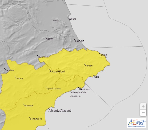
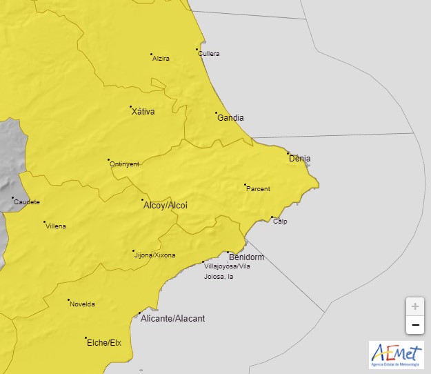
The state meteorological agency AEMET has activated YELLOW alert risk warning for the potential for heavy rain and thunderstorms from 10.00am this morning Wednesday 5th October which could affect many places throughout the Marina Alta region and surrounding areas until midnight tomorrow, Thursday 6th October.
AEMET advises that there is a 40%-70% probability that the Marina Alta region as well as the southern part of the Valencian province and regions inland around Xativa, Villena and Elx and parts of Murcia could see periods of intense rainfall with precipitation rates of 20mm in one hour possible. In addition, the rainfall could be accompanied by thunderstorms.
The risk increases tomorrow Thursday when AEMET advises that there is a 40%-70% probability that the Marina Alta region along with the entire Comunidad Valenciana, Murcia and the eastern coastal areas of Andalusia could see periods of intense rainfall with precipitation rates of 30mm in one hour possible, perhaps as high as 40mm in one hour during intense periods and 60mm could accumulate in twelve hours. In addition, the rainfall could be accompanied by thunderstorms.
It should be remembered that these weather alerts cover large areas – in our case, all of the Marina Alta and El Comtat as well as the northern part of L’Alcoià, much of it quite mountainous – and in his daily forecast for the town, MeteoXàbia‘s Toni Bolufer, suggests that it is unlikely Xàbia will be affected too much by the heavier downpours, although he adds that: “you always have to be prepared [because] you never know when a thunderstorm or a heavy downpour may arrive”.
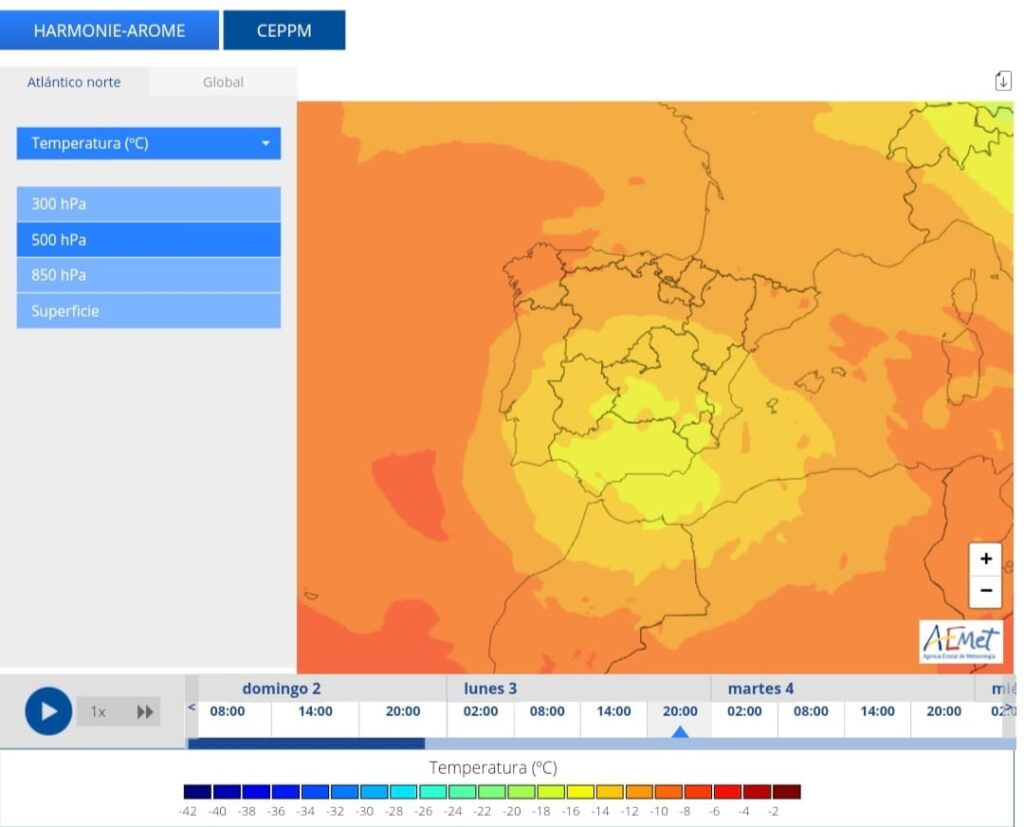
The Climatology Department at the University of Alicante confirms that a cold drop – a “gota fría” – moving through the southern straits will produce an unstable and variable environment in the south-east of the peninsula. Irregular showers and storms are to be expected in our area, which will be locally intense at times, whilst there will also be moments of sun and tranquility.
They have also issued a reminder that a “gota fría” is simply a pocket of cold air at height and that it is a mistake to use this term as a synonym for torrential rain. Not all “gota frías” cause torrential rains, nor are all intense rains associated with them.

Wednesday 5th October 2022 
Thursday 6th October 2022

Note: The alert doesn’t mean that these conditions are definitely going to affect us here in Xàbia but that the models are showing that there is a good chance that they may do so so it’s best to be prepared.
Prepare for the Worst
- Check guttering and drains. They should be clear of leaves and other debris to allow the rainwater to flow away easily. Take a look at the drains in the street in front of your property. It’s the council’s job to keep them clear but checking them yourself before the arrival of heavy rain can help protect your home.
- Prepare the terrace and garden. Cover up and secure patio furniture. Bring in anything that is likely to be blown around the garden and cause damage.
- Protect valuables. If you live in an area that is liable to flooding, you might want to consider gathering together any valuable or sentimental items and store them in a safe area of the house – not the basement – during the periods of heavy rain. Just in case. Material items can be replaced, memories can’t.
- Avoid driving. During periods of heavy rain, it is best to stay put, wherever you are, and avoid driving in low-lying areas and zones where water is likely to collect. Don’t attempt to cross the river if the water is flowing as it may be deeper and stronger than it appears; it only takes a few centimetres of fast flowing water to dislodge a vehicle. If the heavy rain causes poor visibility whilst driving, stop and wait until it passes.


