AEMET issues warning for the potential for heavy rain and thunderstorms in the Marina Alta
The alert doesn’t mean that these conditions are definitely going to affect us but that the models are showing that there is a good chance that they may do so so it’s best to be prepared.

Wednesday 21st September 2022 – Mike Smith
Sources: AEMET / University of Alicante
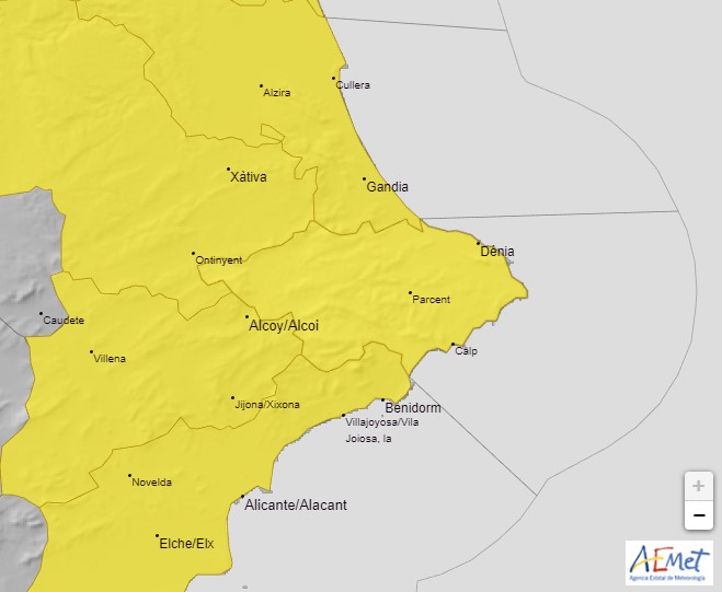
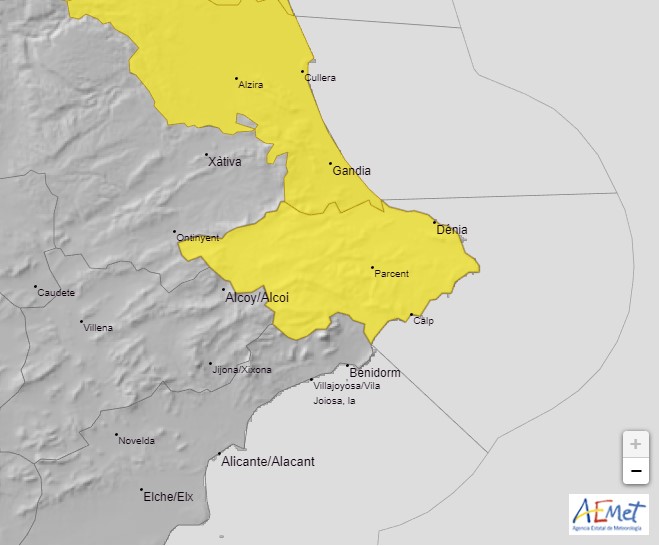
The state meteorological agency AEMET has activated YELLOW alert risk warning for the potential for heavy rain and storms from 5.00pm this afternoon Wednesday 21st September which could affect many places throughout the Marina Alta region and surrounding areas until 3.00pm tomorrow, Thursday 22nd September.
AEMET advises that there is a 40%-70% probability that the Marina Alta region as well as the southern part of the Valencian province and regions inland around Xativa, Villena and Elx could see periods of intense rainfall with precipitation rates of 20mm in one hour possible and up to 30mm in one hour during the most intense periods. In addition, the rainfall could be accompanied by thunderstorms which may produce hail. The risk reduces during the affected period, particularly after midnight tonight.
It should be remembered that these weather alerts cover large areas – in our case, all of the Marina Alta and El Comtat as well as the northern part of L’Alcoià, much of it quite mountainous – and in his daily forecast for the town, MeteoXàbia‘s Toni Bolufer, suggests that it is unlikely Xàbia will be affected by the heavier downpours, although he adds that: “it may rain in the village next door and not here, or even within the same town in one place and not another”.
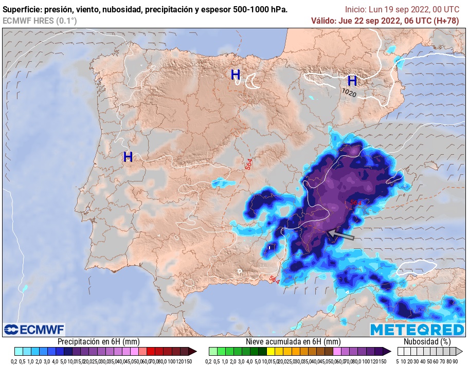
The Climatology Department at the University of Alicante has been monitoring the movement of a small DANA which developed over the Canary Islands and is moving across the southern part of the Iberian Peninsula, a situation which, they agree, has the potential to bring local heavy downpours and storms to the eastern seaboard of Spain. However, they reiterate that it is “an extremely complex situation” with the very high temperature of the Mediterranean adding to the uncertainty. They assure the population that this is a typical situation for the time of year – cold air at height, a warm sea and maritime winds – and that the passage of troughs or a DANA (‘gota fría’) is quite common. But, despite the fact that those two words – ‘gota fría’ – spark panic amongst some residents, only a small percentage generate large episodes of torrential rains and it is more common for scattered intense storms to generate.

Note: The alert doesn’t mean that these conditions are definitely going to affect us here in Xàbia but that the models are showing that there is a good chance that they may do so so it’s best to be prepared.
Prepare for the Worst
- Check guttering and drains. They should be clear of leaves and other debris to allow the rainwater to flow away easily. Take a look at the drains in the street in front of your property. It’s the council’s job to keep them clear but checking them yourself before the arrival of heavy rain can help protect your home.
- Prepare the terrace and garden. Cover up and secure patio furniture. Bring in anything that is likely to be blown around the garden and cause damage.
- Protect valuables. If you live in an area that is liable to flooding, you might want to consider gathering together any valuable or sentimental items and store them in a safe area of the house – not the basement – during the periods of heavy rain. Just in case. Material items can be replaced, memories can’t.
- Avoid driving. During periods of heavy rain, it is best to stay put, wherever you are, and avoid driving in low-lying areas and zones where water is likely to collect. Don’t attempt to cross the river if the water is flowing as it may be deeper and stronger than it appears; it only takes a few centimetres of fast flowing water to dislodge a vehicle. If the heavy rain causes poor visibility whilst driving, stop and wait until it passes.


